
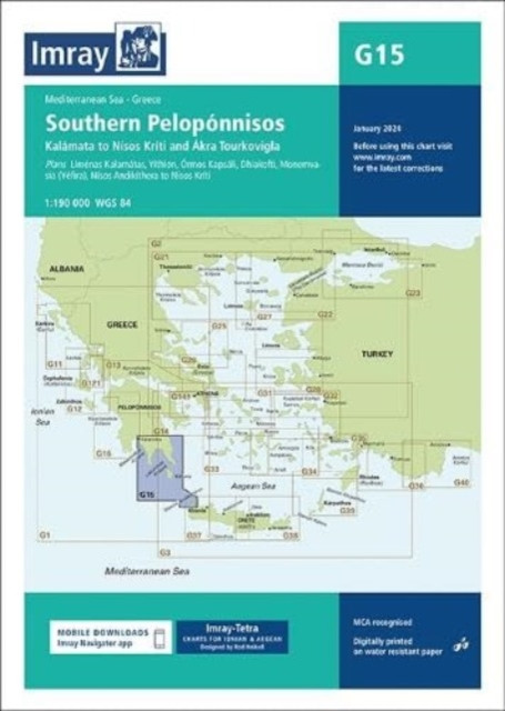
Imray Chart G15 - Southern Peloponnisos (Imray)(Sheet map, folded) - diskuze
Výrobce: Imray,Laurie,Norie & Wilson Ltd
EAN: 9781786795502
Výrobní číslo: 9781786795502
Chart scale 1:190 000Plans included:Liménas Kalamátas (1:12 500)YÃthion (1:12 500)Órmos Kapsáli (1:5000)Dhiakofti (1:12 500)MonemvasÃa (Yéfira) (1:7500)NÃsos AndikÃthera to NÃsos KrÃti (1:190 000)Imray-Tetra charts for the Ionian and Aegean are widely acknowledged as the best available for the cruising sailor. They combine the latest official survey data with first-hand information gathered by Rod and Lucinda Heikell. The chart is designed to be used alongside Imray pilot guides of the area. Like all Imray charts, they are printed on water resistant Pretex paper for durability, and they include many anchorages, facilities and inlets not included on official charts.This edition includes the latest official data combined with additional information sourced from Imray's network to make it ideal for small craft. It includes the latest official bathymetric surveys. There has been general updating throughout.
Cena 791 Kč v 1 obchodě
Dotazy, recenze a diskuze k Imray Chart G15 - Southern Peloponnisos (Imray)(Sheet map, folded)
Přidat dotaz
Přidat rezenci, hodnocení
Přidat rezenci, hodnocení
 MFP Omalovánky Lada A5 - Bajky - 53005
 Série C-L
 One Day in the Life of Ivan Denisovich
 Jak na příšery
- Zbytovská Danie
Jak na příšery
- Zbytovská Danie Kant a Husserl o zkušenosti - Trnka Ja
 And the Mountains Echoed
 Hry na prázdniny
 BETEXA, zásilková služba s. r. o. Dies
 Ohnivý most
- Šnajdr Miroslav
Ohnivý most
- Šnajdr Miroslav Čestní doktoři Univerzity Karlovy 1848
 Iustus 2
 Mýty Lakotů






















Přidat dotaz