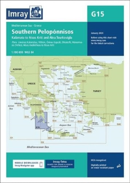
Imray Chart G15 - Southern Peloponnisos (Imray)(Sheet map, folded)
Výrobce: Imray,Laurie,Norie & Wilson Ltd
EAN: 9781786795502
Výrobní číslo: 9781786795502
Chart scale 1:190 000Plans included:Liménas Kalamátas (1:12 500)YÃthion (1:12 500)Órmos Kapsáli (1:5000)Dhiakofti (1:12 500)MonemvasÃa (Yéfira) (1:7500)NÃsos AndikÃthera to NÃsos KrÃti (1:190 000)Imray-Tetra charts for the Ionian and Aegean are widely acknowledged as the best available for the cruising sailor. They combine the latest official survey data with first-hand information gathered by Rod and Lucinda Heikell. The chart is designed to be used alongside Imray pilot guides of the area. Like all Imray charts, they are printed on water resistant Pretex paper for durability, and they include many anchorages, facilities and inlets not included on official charts.This edition includes the latest official data combined with additional information sourced from Imray's network to make it ideal for small craft. It includes the latest official bathymetric surveys. There has been general updating throughout.
Cena 791 Kč v 1 obchodě
Obchody, které prodávají Imray Chart G15 - Southern Peloponnisos (Imray)(Sheet map, folded)

Zobrazit historii ceny Imray Chart G15 - Southern Peloponnisos (Imray)(Sheet map, folded)
Historie nejnižsí ceny Imray Chart G15 - Southern Peloponnisos (Imray)(Sheet map, folded). Porovnání obchodů, které prodávají Imray Chart G15 - Southern Peloponnisos (Imray)(Sheet map, folded).
 Úvod do kryptografie
 Pravdou proti moci
 Zajatcem v Rusku
- Hahn Hans "As
Zajatcem v Rusku
- Hahn Hans "As Alpy - trekové okruhy
 Linc Vladimír, Kábele František: Slabi
 Monstress Volume 2 : The Blood
-
Monstress Volume 2 : The Blood
- Psáno na vodu palbou kulometnou II - J
 Vilma běží o život - Pažoutová Naďa
 Oheň
Oheň Mickey Mouse - Maluj vodou
 Twin Peaks: The Final Dossier
 Gévaudanské nestvůry aneb zrod bestie