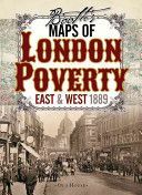
Booth's Maps of London Poverty, 1889 - East & West London (Booth Charles)(Sheet map)
EAN: 9781908402806
Two maps of Victorian London colored street by street show the lifestyle of the inhabitants from the wealthy upper classes to the vicious and semi-criminal lowest class. These two maps classify London streets into seven categories from the very poor lowest class mainly in the east end (but with some surprising enclaves in the fashionable west) right up to the wealthy upper classes in Marylebone and Mayfair. A fascinating resource for genealogists and all lovers of London's past.
Charles Booth was appalled by conditions in London's docklands and vowed to do something about it. Realising that the situation needed to be accurately assessed he published numerous surveys that reported on the living conditions, lifestyle and income of
Charles Booth was appalled by conditions in London's docklands and vowed to do something about it. Realising that the situation needed to be accurately assessed he published numerous surveys that reported on the living conditions, lifestyle and income of
Cena 370 Kč v 1 obchodě
Obchody, které prodávají Booth's Maps of London Poverty, 1889 - East & West London (Booth Charles)(Sheet map)
Zobrazit historii ceny Booth's Maps of London Poverty, 1889 - East & West London (Booth Charles)(Sheet map)
Historie nejnižsí ceny Booth's Maps of London Poverty, 1889 - East & West London (Booth Charles)(Sheet map). Porovnání obchodů, které prodávají Booth's Maps of London Poverty, 1889 - East & West London (Booth Charles)(Sheet map).