
Imray Chart C52 - Cardigan Bay to Liverpool (Imray)(Sheet map, folded) - diskuze
Výrobce: Imray
EAN: 9781786794987
Výrobní číslo: 9781786794987
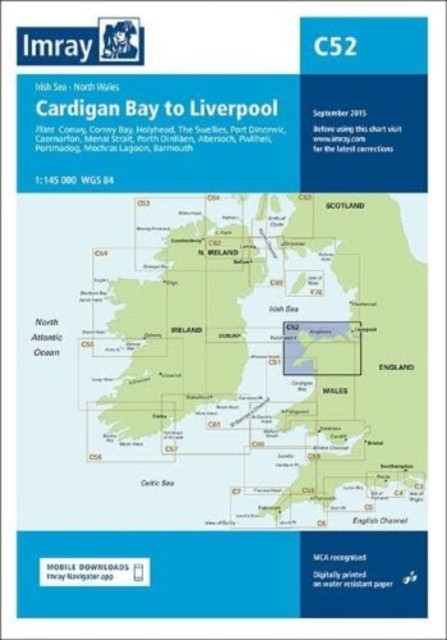
Plans included: Conwy (1:30 000) Conwy Bay (1:60 000) Holyhead (1:27 500) The Swellies (1:15 000) Port Dinorwic (1:15 000) Caernarfon (1:15 000) Menai Strait (1:60 000) Porth Dinlläen (1:17 500) Abersoch (1:15 000) Pwllheli (1:15 000) Porthmadog (1:10 000) Mochras Lagoon (1:15 000) Barmouth (1:30 000) This edition includes the latest official UKHO Digital, combined with additional information sourced from Imray's network to make it ideal for small craft. The chart has been fully revised throughout. The harbour plan of Holyhead has been reschemed to a scale of 1:27 500. The chart includes charting and tidal Digital for passage, approach, and mooring, and is designed to be used alongside Cruising Anglesey and adjoining waters by Ralph Morris and the Irish Sea Pilot by David Rainsbury, both published by Imray.
Cena 956 Kč v 1 obchodě
Dotazy, recenze a diskuze k Imray Chart C52 - Cardigan Bay to Liverpool (Imray)(Sheet map, folded)
Přidat dotaz
Přidat rezenci, hodnocení
Přidat rezenci, hodnocení
 The Buried Giant
 Letiště - Samolepková knížka
-
Letiště - Samolepková knížka
-  The Crime Book : Big Ideas Simply Expl
 The Girl on the Train - Paula Hawkins
 Důvěra a demokracie - Přehled sociolog
 Průvodce výtvarným uměním II
 Čestní doktoři Univerzity Karlovy 1848
 Queen Helene pleťová maska na akné 227
 Duše stromů - Pohnerová Marta, Zerzán
  New York - Lonely Planet
- neuve
New York - Lonely Planet
- neuve One Day in the Life of Ivan Denisovich
 Bezmocná - Würll Dominika




















Přidat dotaz