Oxford International Primary Atlas (Wiegand Patrick)(Paperback) - diskuze

Výrobce: Oxford University Press
EAN: 9780198480228
Výrobní číslo: 9780198480228
This new edition of the Oxford International Primary Atlas is clear, bright and informative. It includes up-to-date country data, easy-to-read colourful mapping, and worldwide topographic content, including areas such as Europe, Malta, Cyprus, Middle East, Malaysia and Hong Kong. It features key geographical themes such as landscapes, water, settlements, connections, and environments. Information is presented in an accessible format based on research into how young children use maps, and easy-to-use features include learning statements to summarize each theme, focus panels to prompt independent or group enquiry, innovative grid codes to help children find places listed in the index, many colourful photographs to aid children''s understanding of map symbols, attractive artwork to provide a ''sense of place'', and stimulating graphics to make large numbers easy to understand.The atlas includes:· Learning statements to introduce each geographical theme· Clear and colourful maps of the world and all the continents· Stunning aerial photographs and satellite images· Focus panels to prompt further enquiry and topic discussion· Child-friendly grid codes and index to support their use of the atlasThe Oxford International Primary Atlas is also accompanied by an Activity Book for independent work to develop map literacy skills.
Cena 363 Kč v 1 obchodě
Dotazy, recenze a diskuze k Oxford International Primary Atlas (Wiegand Patrick)(Paperback)
Přidat dotaz
Přidat rezenci, hodnocení
Přidat rezenci, hodnocení
 Rodigan: My Life in Reggae - Rodigan D
 Velitelé praporů SOS - Lášek Radan
 Brazílie - Jan Klíma
 Čakry pro začátečníky
 Angličtina Magnetická obrázková učebni
 Kdo nelepí, není in! Minnie
 Kódy vědomí
 Mystérium Marsu
 Samolepková knížka Vesmír
 Muž a žena - CDmp3 - Viewegh Michal
 English Vocabulary in Use Elementary w
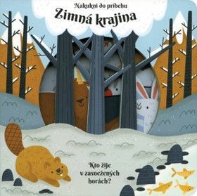 Zimná krajina


Přidat dotaz