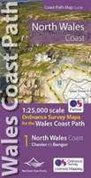
North Wales Coast Path Map - 1:25,000 scale Ordnance Survey mapping for the Wales Coast Path(Paperback / softback) - diskuze
Výrobce: Northern Eye Books
EAN: 9781908632586
Výrobní číslo: 9781908632586
One of seven handy, lightweight, pocket sized map bookscovering the whole of the 870 mile/1400 kilometre Wales Coast Path. This volume covers North Wales from Chester to Bangor and includes enhanced large scale (1:25,000) Ordnance Survey mapping in a handy atlas
Cena 330 Kč v 1 obchodě
Dotazy, recenze a diskuze k North Wales Coast Path Map - 1:25,000 scale Ordnance Survey mapping for the Wales Coast Path(Paperback / softback)
Přidat dotaz
Přidat rezenci, hodnocení


Přidat dotaz