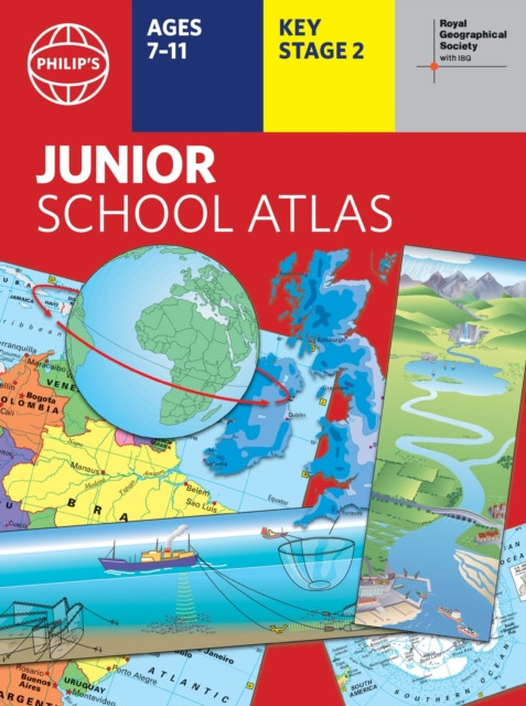
"Philip's RGS Junior School Atlas" - "12th edition PB" ("Philip's Maps")(Paperback / softback) - diskuze
Výrobce: Octopus
EAN: 9781849076890
Výrobní číslo: 9781849076890
The 12th edition of the market-leading atlas for primary school pupils, Philip''s RGS Junior School Atlas has been fully revised and updated with all the latest facts and curriculum requirements.- The essential atlas for primary schools with clear and easy-to-follow maps and diagrams - updated for 2024/2025- Published in association with the Royal Geographical Society- Recommended for Key Stage 2 of the National Curriculum - and all 7-11 year olds - An excellent introduction to mapping concepts such as scale, direction, symbols, longitude and latitude- 22-page Britain and Ireland section with clear thematic charts, diagrams and large-scale regional maps- 22-page section on The World, with political maps - and thematic treatment of key themes, from volcanoes and earthquakes to transport and tourism- Continents section with physical and political maps- Easy-to-follow map references and 1,000-place indexThe introductory section describes the meaning of scale, how to measure distances using the maps, and explains the symbols on the maps.The following section is devoted to the United Kingdom and Ireland. Thematic maps cover topics such as mountains and rivers, climate and weather, population and cities, farming and fishing, industry and energy, transport, tourism and conservation. The rest of the atlas is made up of world thematic maps and world continental maps. Included are topics such as the world''s climate, vegetation, agriculture, energy sources, and environmental concerns,
Cena 297 Kč v 1 obchodě
Dotazy, recenze a diskuze k "Philip's RGS Junior School Atlas" - "12th edition PB" ("Philip's Maps")(Paperback / softback)
Přidat dotaz
Přidat rezenci, hodnocení
Přidat rezenci, hodnocení
 The African Queen
 Encyklopedie moderního bylinářství A-C
 La Šé'Z Pjér: Indián - Zpráva O Archet
 Brazílie - Jan Klíma
 Rychlé večeře (Edice Apetit)
- n
Rychlé večeře (Edice Apetit)
- n MFP Paper s.r.o. Omalovánky MFP Motork
 Trnový císař
- Lawrence Mark
Trnový císař
- Lawrence Mark Raduga 3 - Metodická příručka
-
Raduga 3 - Metodická příručka
-  Dějiny českých zemí
 Herbia Omalovánky A5 V moři
 McMafia : Seriously Organised Crime (F
 Sambo tu již nebydlí?


Přidat dotaz